
Page 7 - VODIC KRAS-a Sapicama po PGZ-u HR
P. 7
the coastal area
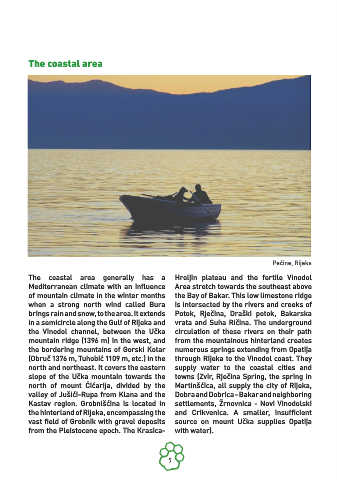
Pećine, Rijeka
The coastal area generally has a Hreljin plateau and the fertile Vinodol
Mediterranean climate with an influence Area stretch towards the southeast above
of mountain climate in the winter months the Bay of Bakar. This low limestone ridge
when a strong north wind called Bura is intersected by the rivers and creeks of
brings rain and snow, to the area. It extends Potok, Rječina, Draški potok, Bakarska
in a semicircle along the Gulf of Rijeka and vrata and Suha Ričina. The underground
the Vinodol channel, between the Učka circulation of these rivers on their path
mountain ridge (1396 m) in the west, and from the mountainous hinterland creates
the bordering mountains of Gorski Kotar numerous springs extending from Opatija
(Obruč 1376 m, Tuhobić 1109 m, etc.) in the through Rijeka to the Vinodol coast. They
north and northeast. It covers the eastern supply water to the coastal cities and
slope of the Učka mountain towards the towns (Zvir, Rječina Spring, the spring in
north of mount Ćićarija, divided by the Martinšćica, all supply the city of Rijeka,
valley of Jušići-Rupa from Klana and the Dobra and Dobrica - Bakar and neighboring
Kastav region. Grobnišćina is located in settlements, Žrnovnica - Novi Vinodolski
the hinterland of Rijeka, encompassing the and Crikvenica. A smaller, insufficient
vast field of Grobnik with gravel deposits source on mount Učka supplies Opatija
from the Pleistocene epoch. The Krasica- with water).
7